

State review process
On this page:
On February 28, 2025, the Minnesota Public Utilities Commission approved the Certificate of Need and Route Permit for the Northland Reliability Project. View the PUC Order. If you are a landowner within the approved route, you will receive additional information from our project team in the coming weeks.
Regulatory process
Click to enlarge
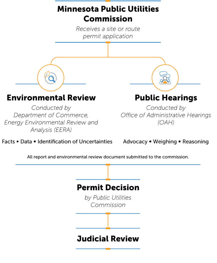
- Minnesota Public Utilities Commission receives a site or route permit application
- Environmental Review conducted by Department of Commerce, Energy Environmental Review and Analysis, finding facts, data and identifying uncertainties
- Public Hearings conducted by Office of Administrative Hearings for advocacy, weighing and reasoning
- All report and environmental review document submitted to the commission.
- Permit Decision by Public Utilities Commission
- Judicial Review
- August 2023: We submitted our proposed route in our application for a Certificate of Need and Route Permit to the Minnesota PUC.
- October 2023: The PUC and Department of Commerce held scoping meetings in October 2023 and through that process identified routing alternatives to be evaluated in an Environmental Assessment.
- March 2024: An Environmental Assessment Scoping Decision was published in March 2024.
- June 2024: An Environmental Assessment was published by the Department of Commerce on June 28, 2024.
- July 2024: Public hearings held on the project July 22 - 26, 2024.
- November 2024: Proposed Findings of Fact, Conclusions of Law, and Recommendation was published on November 8, 2024.
- January 2025: The Minnesota Public Utilities Commission issues oral decision approving Certificate of Need and Route Permit. The official permit documents will be posted once available.
- February 28, 2025: The Minnesota Public Utilities Commission approved the Certificate of Need and Route Permit. View the PUC Order.
Participate in the regulatory process
You can subscribe to receive updates from the PUC. Visit edockets.state.mn.us and enter the docket number you're interested in tracking:
- Certificate of Need use docket 22-416
- Route Permit use docket 22-415